Project Approach

Project approach

Objectives and methods

NABU and it’s six partners work together on their organisational development through mutual learning, to intensify their regional collaboration including transboundary and interregional governance and to enhance their expertise in innovative agricultural methods.

AfriEvolve is conceived as a pan-African co-support platform facilitating peer-to-peer learning exchanges and south-south mentoring and capacity building among its members. The activities of the project contribute to newly gained organisational development skills for improving civil society cooperation. Furthermore, the partners increase their expertise in Climate Smart Agriculture while farmers at the six pilot sites are benefitting directly.

Organisational capacities

NABU and six African NGOs are setting up regional cluster networks for enhancing organisational development for each of the partner organisations and supporting local farmers in adapting agricultural systems to climate change. Ghana Wildlife Society, NATURAMA, Nature Kenya, Nature Tanzania, Nature Uganda and SOS-Forêts represent a wide range of green NGOs in Africa. Two regional clusters, East and West Africa, were formed, each comprising three partners with different levels of capacity and development.
at
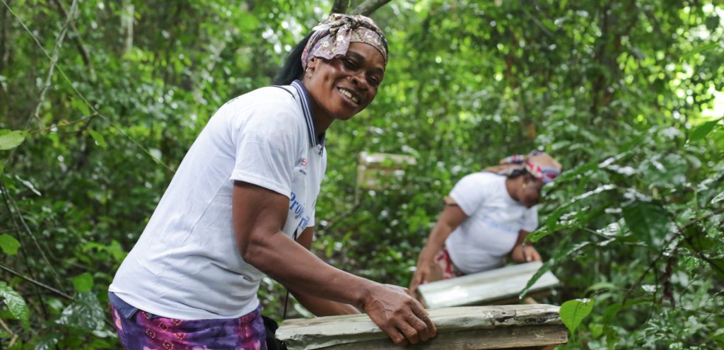
Beneficiaries of the AfriEvolve project at a training for sustainable beekeeping in the rainforest in Côte d’Ivoire. – photo: SOS-Forêts

All six partners work with different approaches to conservation and income generation, depending on the country, the characteristics of the wider habitat and its people as well as the specific local challenges. Although those challenges and framework conditions are often similar, the NGOs can hardly exchange with each other due to lack of opportunities and financial constraints.

All six NGOs are accredited members (or in the process of accreditation) of BirdLife International, a global network of conservation organisations, who’s mission it is to conserve birds, their habitats and global biodiversity and to work with people toward sustainability in the use of natural resources. There over 115 BirdLife partners worldwide.

Climate Smart Agriculture

The effects of climate change, with unpredictable weather phenomena such as heavy rainfall, frost, extreme dry periods with corresponding consequences such as erosion, are already exacerbating crop failures and losses and thus poverty and people’s dependence on the natural resources of their environment. The socio-economic impacts of the Covid-19 pandemic have contributed to increased poverty and the often already high pressure on natural resources. One way to help reducing this pressure is the conversion of land to more sustainable forms of use that are at the same time better adapted to the impacts of climate change, summarised as Climate Smart Agriculture (CSA).
at
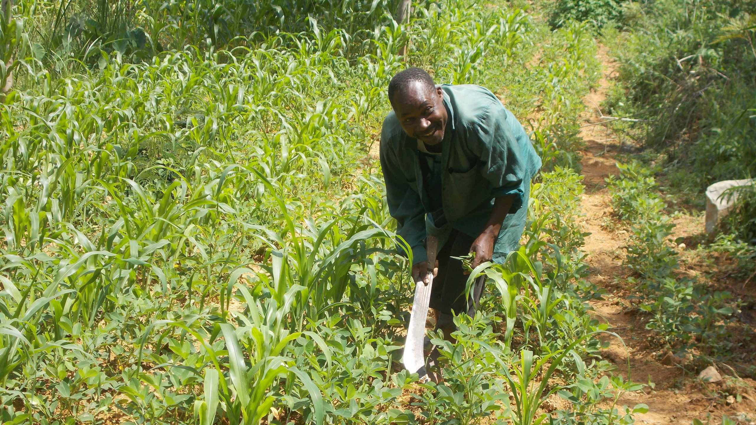
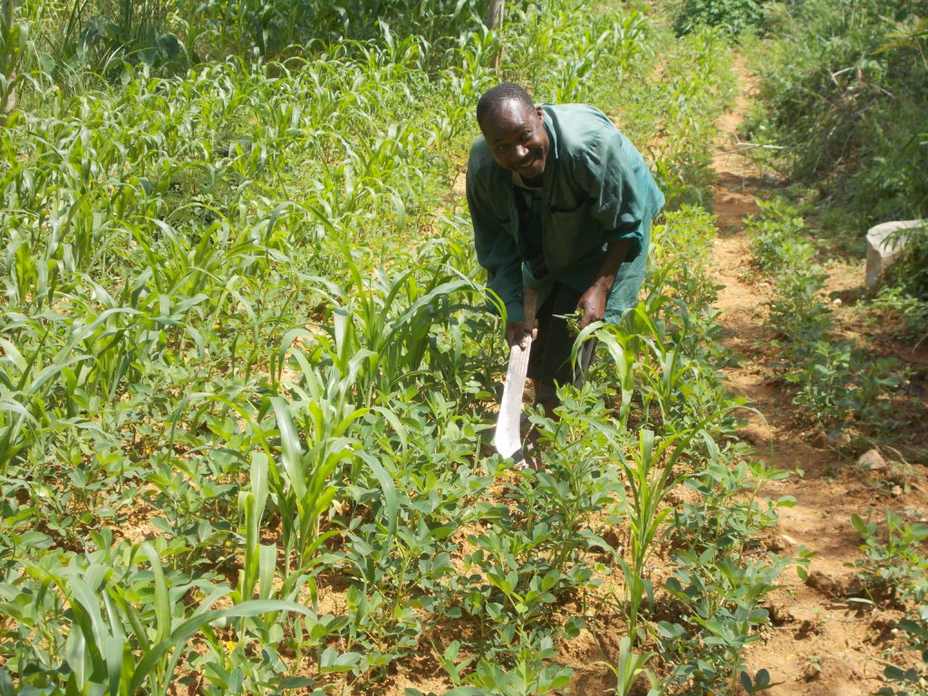
A beneficiary farmer implementing intercropping – one of the Climate Smart Agriculture techniques at a farm in Ndiha village. – photo: Nature Kenya

The FAO defines Climate Smart Agriculture as “an approach that helps guide actions needed to transform and reorient agricultural systems to effectively support development and ensure food security in a changing climate”. Climate Smart Agriculture has three main objectives: to sustainably increase agricultural productivity and incomes; to adapt to climate change and build resilience; and to reduce and/or eliminate greenhouse gas emissions wherever possible. Climate Smart Agriculture is an approach for developing agricultural strategies to ensure sustainable food security under climate change conditions. Climate Smart Agriculture offers actors at local, national and international levels the opportunity to develop agricultural strategies that suit their local conditions.

As all six project partners have limited experience with Climate Smart Agriculture but consider it a highly suitable approach to link nature conservation, climate change challenges and land use needs. Therefore, it was decided to develop pilot sites in each of the six project countries. For this, each NGO independently identified a suitable geographical area, considering the specific context carefully, in their country to pilot Climate Smart Agriculture tailored to local conditions.

The criteria for the selection of the target region included:

  • the existing extent of climate change impacts
  • the neediness and motivation of the target group
  • the partners existing knowledge of and experience with agricultural use and methods as well as affected habitat types
  • the compatibility with priority conservation areas (IBAs, KBAs)
  • the political as well as the security context
  • the partners existing local implementation structures
  • the partners existing linkage to local communities and governments
at
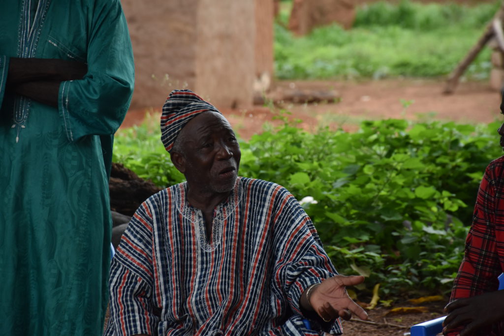
Only in close exchange and cooperation with the communities can AfriEvolve be successful. – photo: Ghana Wildlife Society

Project coordination / Coordination du projet

Funder / Bailleur de fonds

Ghana

Project partner

Ghana Wildlife Society

Pilot project region

Mole National Park

Mole Nationalpark is mainly structured by open savannah forests with a high ornithological importance and is a significant wintering area for many migratory bird species.

Côte d’Ivoire

Project partner

SOS-Forêts

Pilot project region

Azagny Nationalpark

Azagny Nationalpark consists of lagoons, evergreen (primary) forests, dry and wet coastal savannah, wetlands and mangrove areas, which are home to around 134 plant species and rare, endangered animal species.

Kenya

Project partner

Nature Kenya

Pilot project region

Yala Swamp

Yala Swamp, the largest freshwater swamp of Kenya, is a Key Biodiversity Area (KBA) at the north-eastern end of Lake Victoria and is providing vital resources to about 250,000 farmers.

Burkina Faso

Project partner

NATURAMA

Pilot project region

Sourou Valley

Sourou Valley is a Sahelian riverine gateway from Mali to Burkina Faso with broad floodplain marshes and acacia forests.

Uganda

Project partner

Nature Uganda

Pilot project region

Echuya Forest Reserve

Echuya Forest Reserve is a highland forest area at an altitude of 2,570 meters in the heart of the biodiversity rich Albertine Rift in western Uganda.

Tanzania

Project partner

Nature Tanzania

Pilot project region

Amani Forest Reserve

Amani Forest Reserve in the Tanzanian East Usambara Mountains is covered with remnants of very old forests and is of outstanding importance for nature and species conservation.

Tanzania, East Usambara Forest

The Usambara Mountains are located in the northeast of Tanzania, not far from the Indian Ocean coast and the border with Kenya, in the Tanga region. The mountains are partly still covered with remnants of very old (> 30 million years) forests and are of outstanding importance for nature and species conservation.

At the same time, the forests (a biosphere reserve and Amani Nature Reserve since 1997) are under severe pressure from high population density (120,000 people in 61 villages) due to logging, unsustainable agriculture, invasive species, gold mining and climate change.

Make cultivation more profitable and climate-adaptive

In the Amani Natural Forest Reserve, about 30,000 people live on 8,380 ha in Muheza district and are suffering from the impacts of climate change. Their food security is threatened by climate change and loss of ecosystem services, increasingly leading to the degradation of livelihoods of village communities. Spice cultivation is one of the main agricultural activities in Amani. However, there is a lack of skills, capacity and capital at the local level to make cultivation more profitable and climate-adaptive.

As part of AfriEvolve, Climate Smart Agriculture on smallholder spice farms is improved by micro-compost systems and agroforestry. Additionally, sustainable and innovative marketing strategies are promoted through a revolving fund system.

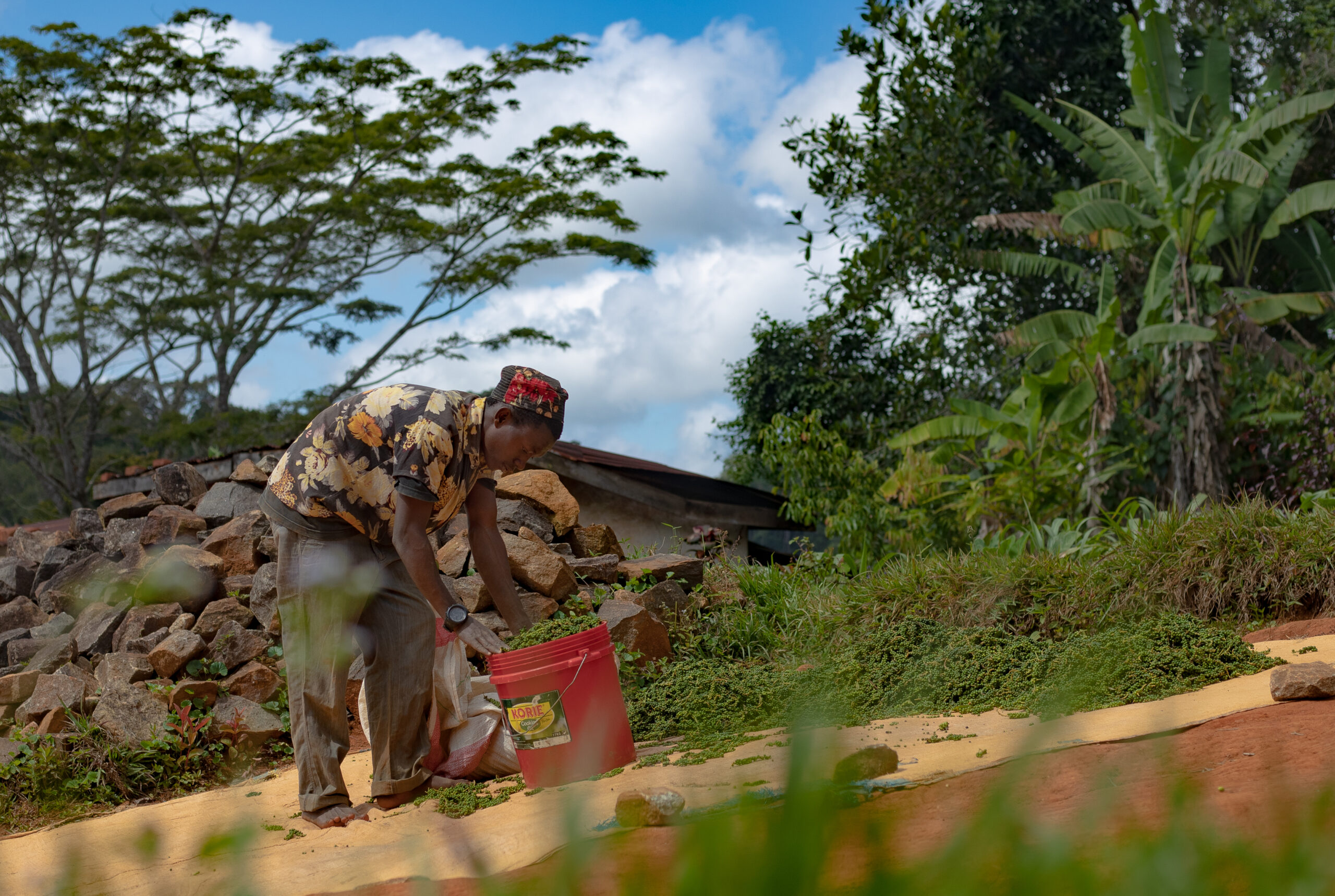
Organically grown pepper from the slopes of the East Usambara Mountains is dried in the sun and prepared for processing. – photo: Nature Tanzania

Burkina Faso, Sourou Valley

The Sourou Valley is a river valley on the border with Mali with a total area of 20,926 hectares. The valley consists of broad floodplain marshes and acacia forests. Large parts of the area are dominated by agricultural land, where only trees of economic value remain.

The valley is an Important Bird Area (IBA), but the natural resources are under considerable pressure: loss of floodplain forests due to agriculture, firewood collection, especially for fish smoking, and unsustainable fishing are damaging the area with its important ecosystem services in the long term. Poor soils and the resulting low yields lead to deforestation, which further exacerbates degradation.

Approaches to improve agricultural yields

Climate Smart Agriculture could help local communities in the Sourou Valley to improve their food security while renaturalising ecosystems.

To improve the agricultural yields, compost production has been implemented to generate fertile and nutritious humus that can increase crop yields in the poorer soils of this Sahelian region. Moreover, to create an alternative and sustainable source of income, beekeeping is being tested.

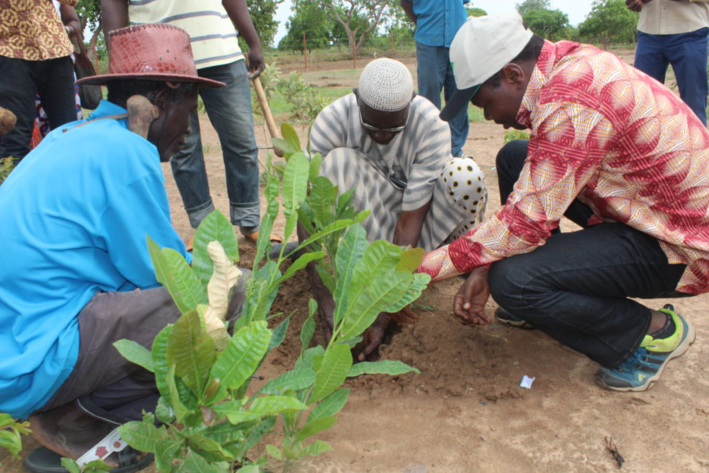
Planting trees in the Sahel region can contribute to making soils more fertile and therefore to an increased ecological value. – photo: NATURAMA

Côte d’Ivoire, Azagny National Park

The Azagny National Park (Région des Lagunes, Ramsar and IBA site) extends 100 kilometres west of Abidjan.

With lagoons, evergreen (primary) forests, dry and wet coastal savannah, wetlands and mangrove areas, the park is home to some 134 plant species and rare, endangered animal species such as forest elephant (Loxodonta africana cyclotis), chimpanzee (Pan troglodytes verus), pygmy hippopotamus (Choeropsis liberiensis), West African manatee (Trichechus senegalensis) and royal antelope (Neotrapus pygmaeus).

Sustainable cultivation of cocoa, coffee and other crops

Like the coastal region of Côte d’Ivoire in general, the protected and buffer zones of the national park face an increasing influx of internal migrants and thus increased pressure on its resources such wild meat, rattan, bast, mangroves. Additionally, in and around the park, oil palm, rubber, coconut, cocoa and coffee are industrially produced.

SOS-Forêts is working at the pilot site with small scale farmers to ensure they are able to grow their crops in a more sustainable and climate smart way. Particular attention is given to the sustainable cultivation of cocoa and beekeeping in agroforestry systems.

at
Beneficiaries of the AfriEvolve project at a training for sustainable beekeeping in the rainforest in Côte d’Ivoire. – photo: SOS-Forêts

Ghana, Mole National Park

Mognori (West Gonja District) is located in north-western Ghana, on the southern edge of Mole National Park.

Its natural vegetation consists of open savannah forests, but these have been severely affected by cattle over-grazing, shifting cultivation and slash and burn agriculture. The park is ornithological significant as an important wintering area for many migratory bird species.

Convey commmunity involvement

The approximately 41,000 inhabitants of Mognori live mainly from the resources of their environment and small-scale agriculture. Conflicts due to a lack of cooperation between communities and park authorities occur, partly due to weak community involvement in natural resource management. Ghana Wildlife Service will take on a mediator role to strengthen the cooperation between communities within the project by taking a mediator role. As an adaptation to the increasing drought in the region due to climate change, modern drip irrigation systems are being tested, which are supplied with energy by a solar system.

at
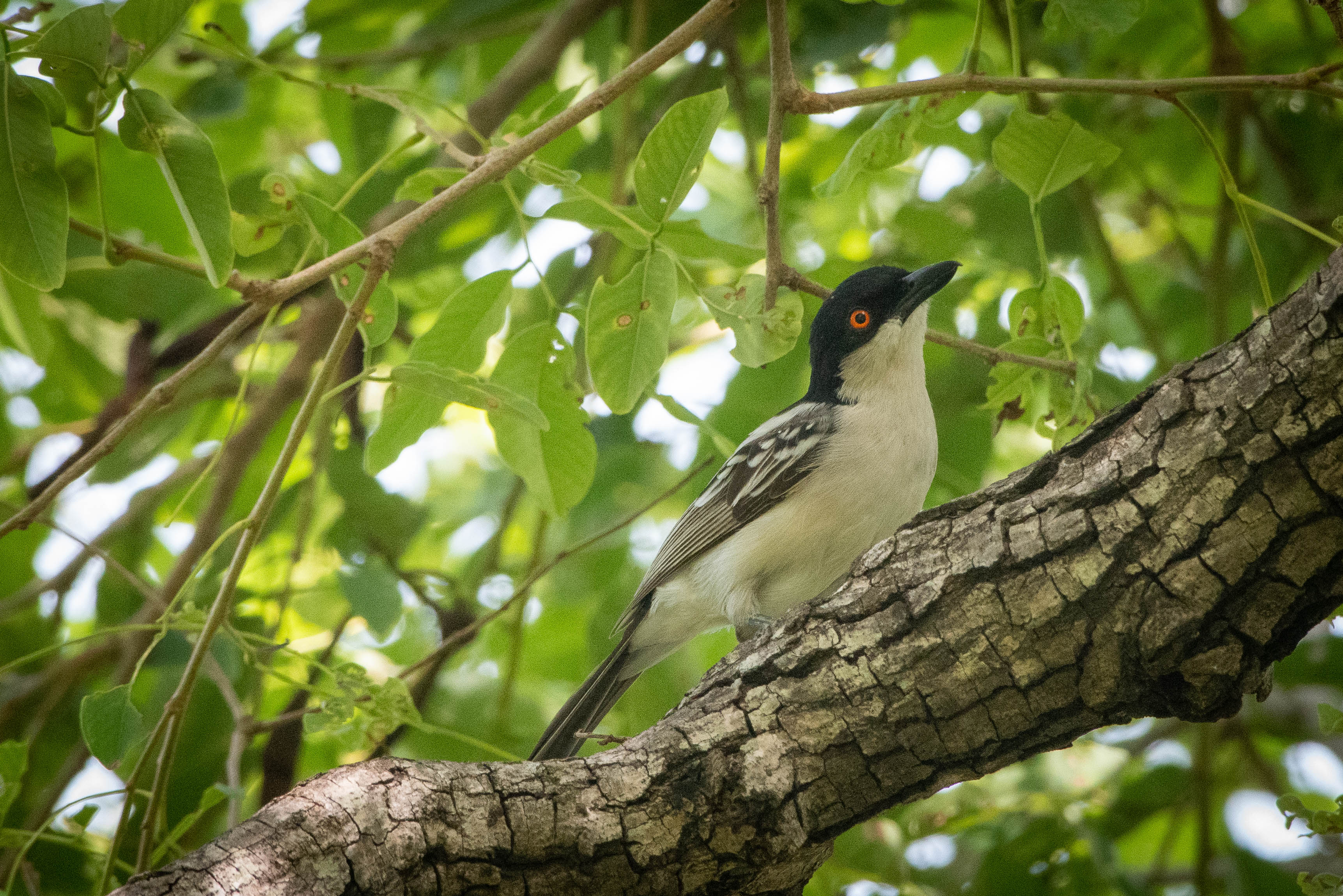
Mole National Park is of great ornithological importance with protected species such as the Northern puffback (Dryoscopus sabini). – photo: Ghana Wildlife Society

Uganda, Echuya Forest Reserve

Echuya Forest Reserve is a highland forest area at an altitude of 2,570 meters in the Albertine Rift in western Uganda, covering about 4,000 hectares. Echuya is in one of the most densely populated and poorest agricultural regions of the country.

The long-term conservation of the reserve depends directly on the surrounding population. With the support of Nature Uganda, the disadvantaged group of local Batwa was able to conclude an agreement with the government on access and sustainable use of the forest and thus finally have legalised access to the resources.

Working hand in hand with local stakeholders

However, what is still missing is the adaptation of agriculture to climate change. Nature Uganda has long-standing relationships with the local people, the government and forest management organisations, and works with the communities to implement Climate Smart Agriculture activities: trainings for farmers in organic agriculture and agroforestry are provided, and other income-generating activities such as beekeeping and small-scale livestock farming are piloted.

a
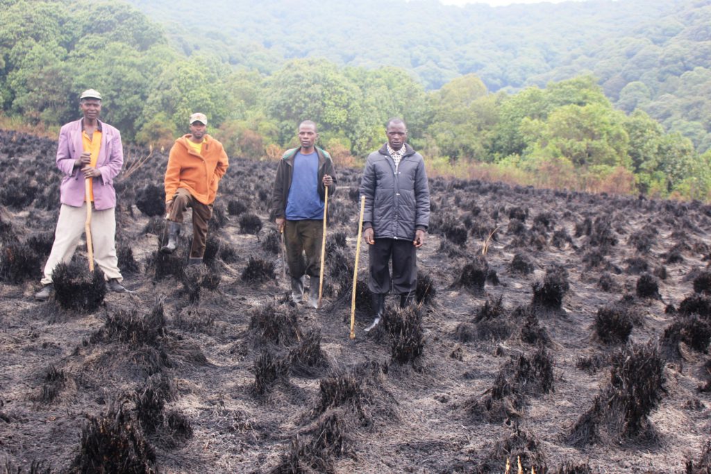
As a result of outdated cultivation methods such as the slash and burn agriculture, many areas are losing their ecological value. – photo: Nature Uganda

Kenya, Yala Delta

The Yala Delta borders with its 20,756 hectares Lake Victoria and is Kenya’s largest freshwater wetland and a Key Biodiversity Area (KBA). It acts as a critical filter for freshwater inflow into Lake Victoria.

The delta provides 250,000 farmers in its vicinity with vital resources such as fish, papyrus and timber. However, Yala’s ability to function is severely threatened by the establishment of large-scale agricultural enterprises by foreign investors and the overexploitation of its natural resources. The population is under enormous economic pressure and agricultural practices are not sustainable.

Land use plan for sustainable development

Due to land conflicts of the delta´s population with large investors, Nature Kenya developed a land use plan for sustainable development with all stakeholders including communities, investors, and the government to combine the different interests in the delta and to secure the income of the local population through Climate Smart Agriculture.

Within the Climate Smart Agriculture trainings, pilot projects such as small-scale fish and poultry farming are implemented. In addition, local youth groups are trained in sustainable beekeeping and honey production, as well as in processing sustainably harvested papyrus from the intact swamps.

A beneficiary farmer implementing intercropping-one of the CSA-CA techniques at a farm in Ndiha village – photo: Nature Kenya

Scroll to Top